Guest blog: Location technology’s role in helping to enable climate action
Guest blog by Miles Gabriel, Head of Business Development, Climate & Disaster Response Program Lead, Esri UK.
Introduction
The devasting recent wildfires in California reminded me of the opening paragraph from my techUK Climate Action blog, which stated:
“What was once an impending climate crisis is now our global climate reality. Climate impacts have escalated to the point of endangering communities and evoking social urgency.”
That statement seems unfortunately prescient now, particularly when viewed alongside Met Office’s recent conclusion that climate change has increased fire risk.
Similar increases in risk are being seen across all extreme weather events like storms, heatwaves, droughts, flooding and other climate-related hazards which are becoming more frequent, more intense and more impactful.
Can location technology help turn the dial on greater action on climate change?
The Location Technology Opportunity
A significant gap still exists between climate science, and its climate projections, and decision-makers in government and industry ultimately responsible for taking action.
Often decision makers are not the traditional scientific, technical and academic users of climate forecast data. They are unlikely to have experience with large observational datasets or complex multidimensional scientific data formats that need to be downloaded, transformed and cleaned before they can be integrated alongside business data to elicit actionable information.
So how can location technology support efforts to close this gap to enable greater understanding, to direct investment and ultimately to help mitigate the future impacts of climate change damages?
Making climate data easier to find, access and integrate democratises it by making it simpler to use and understand, particularly within software platforms designed for non-technical users and decision makers.
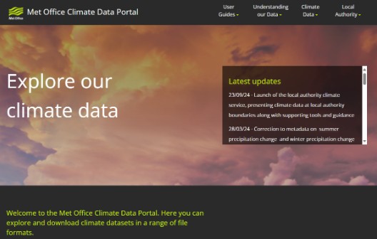
The Met Office Climate Data Portal (CDP), and Esri’s Living Atlas, make climate data available in interoperable, geospatial data formats that enable its integration, visualisation and analysis. This means that the risks faced by an organisation or community can be understood in the context of people, assets, operations, natural systems and specific geographic locations.
Since launch in June 2023, the CDP has had over 55,000 unique visitors who have viewed the UKCP data hundreds of thousands of times, increasing usage more than ten-fold by broadening use beyond the traditional user base.
Emma Teuten, Lead GIS Analyst at RSPB Scotland, provided the following feedback: “The portal makes working with climate data faster and more accurate and saves months of development time when trying to understand the impact of climate change on specific sites in Scotland. We already use Esri’s GIS extensively and the new Met Office portal eliminates the time-consuming data conversion previously required, as the data is now in ready-to-use geospatial formats.”
Climate Services
The evidence is clear that making the UKCP available under FAIR principles has dramatically increased its usage, but what else can location technology do to further close the gap between climate data and its potential end users and decision makers?
Data-driven, scalable climate services may hold the answer.
Digital services, particularly those underpinned by Software as a Service (SaaS) platforms, are inherently scalable, meaning they can be accessed by thousands if not millions of users.
This flexibility, and the fact these services are built upon existing, openly accessible climate data and off-the-shelf software, means they can be rapidly and cost effectively tailored to the specific needs and complexities of discrete industries or communities.
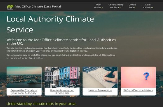
The Met Office worked with Esri UK to build the first of this type of new service in the UK, the Local Authority Climate Service (LACS), launched in October 2024. LACS provides local authorities easy access to tailored information to support local climate change adaptation planning.
Head of Climate Services at the Met Office, Professor Jason Lowe OBE, said: “Local authorities are key in building resilience to climate change in our communities across the UK. It is vital that our climate projections are available in a format that makes them most accessible and useful for local authorities to apply in assessing risks and starting to plan how to best adapt to our changing climate.”
The service, funded by Defra (Department for Environment and Rural Affairs) following a commitment in the third National Adaptation Programme, equips local authorities with critical climate information, helping them to make informed adaptation plans and decisions, empowering organisations to increase their resilience and meet statutory requirements.
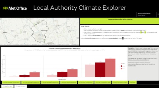
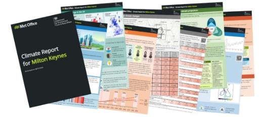
The LACS service has received over 7,500 unique visitors (Oct - Dec), with 8,700 launches of the Local Authority Climate Explorer Dashboard and 7,600 Local Authority Climate Report views.
Engagement with Local Authorities has confirmed that the service is already being used for adaptation planning, impact assessments, awareness raising and building the case for adaptation within councils, and is being built into training and onboarding for new staff:
“It’s a great tool to have in our inventory for raising awareness of climate change and likely impacts.” – Combined Authority
“This type of information is “worth its weight in gold” reducing time spent on data processing.” – Local Authority
Recommendations
Recent studies2,3 conclude that that there is strong acceptance (80%+) in climate change, and corresponding high levels of support for greater climate actions and policies from their governments.
These perceptions should be utilised by government as an opportunity to do more on climate change, and to do it faster.
Evidence of the beneficial role of location technology in helping to enable climate action is indisputable. Geography is essential to understanding and tackling climate risks, and location technology can provide users and decision makers with greater clarity on impacts and implications (i.e. the costs of action or inaction).
This evidence should be used to further the case for developing industry-specific climate services to drive climate awareness, and subsequent increased climate action on preparedness, response, adaptation and mitigation.
Climate, Environment and Sustainability Programme activities
The techUK Climate Programme provides opportunities for members to present tech solutions that assist carbon emission reduction, circularity, and human rights goals. We also help our members with their own net zero transition, including measurement, implementation, compliance, and reporting. Visit the programme page here.
Our 2025 work programme for the Climate, Environment and Sustainability Programme - get involved!
Get involved with our sustainability work in 2025!
As 2024 turns in to 2025 we are really excited to share the work programme for our sustainability programme. The below sets out our focus areas, working groups and programme outline as well as events/webinars and we'd love to get you involved.
Our members develop strong networks, build meaningful partnerships and grow their businesses as we all work together to create a thriving environment where industry, government and stakeholders come together to realise the positive outcomes tech can deliver.
Associate Director for Climate, Environment and Sustainability, techUK
Craig Melson
Associate Director for Climate, Environment and Sustainability, techUK
Craig is Associate Director for Climate, Environment and Sustainability and leads on our work in these areas ranging from climate change, ESG disclosures and due diligence, through to circular economy, business and human rights, conflict minerals and post-Brexit regulation.
Prior to joining techUK he worked in public affairs and policy has an avid interest in new and emerging technologies. Craig has a degree in Ancient History from King’s College London and spends his time watching Watford FC and holding out hope for Half Life 3.
Josh joined techUK as a Programme Manager for Telecoms and Net Zero in August 2024.
In this role, working jointly across the techUK Telecoms and Climate Programmes, Josh is responsible for leading on telecoms infrastructure deployment and uptake and supporting innovation opportunities, as well as looking at how the tech sector can be further utilised in the UK’s decarbonisation efforts.
Prior to joining techUK, Josh’s background was in public affairs and communications, working for organisations across a diverse portfolio of sectors including defence, telecoms and infrastructure; aiding clients through stakeholder engagement, crisis communications, media outreach as well as secretariat duties.
Outside of work, Josh has a keen interest in music, painting and sailing.
Programme Assistant, Data Centres, Climate, Environment and Sustainability, Market Access, techUK
Lucas Banach
Programme Assistant, Data Centres, Climate, Environment and Sustainability, Market Access, techUK
Lucas Banach is Programme Assistant at techUK, he works on a range of programmes including Data Centres; Climate, Environment & Sustainability; Market Access and Smart Infrastructure and Systems.
Before that Lucas who joined in 2008, held various roles in our organisation, which included his role as Office Executive, Groups and Concept Viability Administrator, and most recently he worked as Programme Executive for Public Sector. He has a postgraduate degree in International Relations from the Andrzej Frycz-Modrzewski Cracow University.